TANZANIA NATIONAL PARKS
Tanzania is a country with many tourist attractions. Approximately 38 percent of Tanzania’s land area is set aside in protected areas for conservation.[1] There are 16 national parks,[2] 29 game reserves, 40 controlled conservation areas (including the Ngorongoro Conservation Area) and marine parks. Tanzania is also home to Mount Kilimanjaro, the highest point in Africa.


Travel and tourism contributed 17.5 percent of Tanzania’s gross domestic product in 2016[3] and employed 11.0 percent of the country’s labor force (1,189,300 jobs) in 2013.[4] The sector is growing rapidly, rising from US $1.74 billion in 2004 to US $4.48 billion in 2013.[4] In 2016, 1,284,279 tourists arrived at Tanzania’s borders compared to 590,000 in 2005
LISTS OF NATIONAL PARKS
Arusha National Park covers Mount Meru, a prominent volcano with an elevation of 4566 m, in the Arusha Region of north eastern Tanzania. The park is small but varied with spectacular landscapes in three distinct areas. In the west, the Meru Crater funnels the Jekukumia River; the peak of Mount Meru lies on its rim. Ngurdoto Crater in the south-east is grassland. The shallow alkaline Momella Lakes in the north-east have varying algal colours and are known for their wading birds.
Mount Meru is the second highest peak in Tanzania after Mount Kilimanjaro, which is just 60 km away and forms a backdrop to views from the park to the east. Arusha National Park lies on a 300-kilometre axis of Africa’s most famous national parks, running from Serengeti and Ngorongoro Crater in the west to Kilimanjaro National Park in the east.
The park is just a few kilometres north east of Arusha, though the main gate is 25 km east of the city. It is also 58 km from Moshi and 35 km from Kilimanjaro International Airport (KIA).


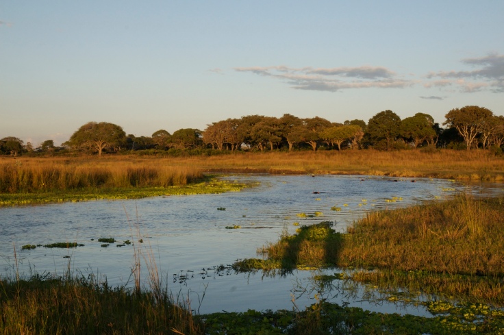
Gombe Stream National Park is located in western Kigoma Region, Tanzania, 10 miles (20 km) north of Kigoma, the capital of Kigoma Region.[2] Established in 1968, Gombe is the smallest national park in Tanzania, with only 20 square miles (52 km2) of forest running along the hills of the eastern shore of Lake Tanganyika.[2][3] The terrain is distinguished by steep valleys, and the forest vegetation ranges from grassland to alpine bamboo to tropical rainforest.[4] Accessible only by boat, the park is most famous as the location where Jane Goodall pioneered her behavioral research conducted on the chimpanzee populations.[2][3] The Kasakela chimpanzee community, featured in several books and documentaries, lives in Gombe Stream National Park.[5]

Katavi National Park is a Tanzanian national park created in 1974 and is located in Katavi Region, Tanzania. It is a very remote park that is less frequently visited than other Tanzanian national parks. The park is approximately 4,471 square kilometers (1,726 sq mi) in area,[2] which makes it the third largest national park in Tanzania. The park encompasses the Katuma River and the seasonal Lake Katavi and Lake Chada floodplains.
Kilimanjaro National Park is a Tanzanian national park, located 300 kilometres (190 mi) south of the equator[1] and in Kilimanjaro Region, Tanzania. The park is located near the city of Moshi.[4] The park includes the whole of Mount Kilimanjaro above the tree line and the surrounding montane forest belt above 1,820 metres (5,970 ft).[1][4] It covers an area of 1,688 square kilometres (652 sq mi), 2°50’–3°10’S latitude, 37°10’–37°40’E longitude.[1] The park is administered by the Tanzania National Parks Authority (TANAPA).[5]

Kitulo National Park is a protected area of montane grassland on the Kitulo Plateau in the southern highlands of Tanzania. The park is at an elevation of 2,600 metres (8,500 ft) between the peaks of the Kipengere and Poroto mountains and covers an area of 412.9 square kilometres (159.4 sq mi),[2] lying in Mbeya Region and Njombe Region. The park is administered by Tanzania National Parks (TANAPA) and is the first national park in tropical Africa to be established primarily to protect its flora.[3]


Lake Manyara National Park is a Tanzanian national park located both in Arusha Region and Manyara Region, Tanzania. The two administrative regions have no jurisdiction over the parks. The park is governed by the Tanzania National Parks Authority. The majority of the land area of the park is a narrow strip running between the Gregory Rift wall to the west and Lake Manyara, an alkaline or soda-lake, to the east.[2]
The park consists of 330 km2 (130 sq mi) of arid land, forest, and a soda-lake which covers as much as 200 km2 (77 sq mi) of land during the wet season but is nearly nonexistent during the dry season.


Mahale Mountains National Park lies on the shores of Lake Tanganyika in Kigoma Region, Tanzania. Named after the Mahale Mountains range that is within its borders, the park has several unusual characteristics. First, it is one of only two protected areas for chimpanzees in the country. (The other is nearby Gombe Stream National Park made famous by the researcher Jane Goodall.) The chimpanzee population in Mahale Mountains National Park is the largest known and due to its size and remoteness, the chimpanzees flourish. It also the only place where chimpanzees and lions co-exist. Another unusual feature of the park is that it is one of the very few in Africa that must be experienced by foot. There are no roads or other infrastructure within the park boundaries, and the only way in and out of the park is via boat on the lake.
The Mahale mountains were traditionally inhabited by the Batongwe and Holoholo people, with populations in 1987 of 22,000 and 12,500 respectively. When the Mahale Mountains Wildlife Research Center was established in 1979 these people were expelled from the mountains to make way for the park, which opened in 1985. The people had been highly attuned to the natural environment, living with virtually no impact on the ecology.[2]


Mikumi national park is bordered to the south with the Selous Game Reserve,[2] the two areas forming a unique ecosystem. Two other natural areas bordering the national park are the Udzungwa Mountains and Uluguru Mountains.
The landscape of Mikumi is often compared to that of the Serengeti. The road that crosses the park divides it into two areas with partially distinct environments. The area north-west is characterized by the alluvial plain of the river basin Mkata. The vegetation of this area consists of savannah dotted with acacia, baobab, tamarinds, and some rare palm. In this area, at the furthest from the road, there are spectacular rock formations of the mountains Rubeho and Uluguru. The southeast part of the park is less rich in wildlife, and not very accessible.


The Serengeti National Park is a Tanzanian national park in the Serengeti ecosystem in the Mara and Simiyu regions.[2][3] It is famous for its annual migration of over 1.5 million white-bearded (or brindled) wildebeest and 250,000 zebra and for its numerous Nile crocodile and honey badger.
The Maasai people had been grazing their livestock in the open plains of eastern Mara Region, which they named “endless plains”, for around 200 years when the first European explorer, Austrian Oscar Baumann, visited the area in 1892.[4] The name “Serengeti” is an approximation of the word used by the Maasai to describe the area, siringet, which means “the place where the land runs on forever”.[5]


